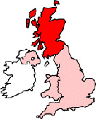
Dumbarton Maps - District Map Dumbarton Scotland
Useful road map of Dumbarton district, town centre and surroundings.
 |
||
Local District Street Map for Dumbarton Dunbartonshire Scotland
Dumbarton Maps: With this easy to print map, you can see local districts of Dumbarton, its central area and surroundings within the county of Dunbartonshire, Scotland in the United Kingdom. Using this detailed Dumbarton map, you can find your way around the town and locate streets, roads and facilities in Dumbarton. The view of the map shown on this page is of the town centre area of Dumbarton, use the minus ( - ) button (bottom right of map) to view districts and surrounding areas, villages, towns and points of interest. Dumbarton district map. You can judge roughly how far Dumbarton is from these nearby places and see the distance between.
Things you can view include: Dumbarton Cemetery, Dumbarton High Street, The River Leven, Dumbarton Train Station (Dumbarton East), Broadmeadow Industrial Estate, Dumbarton Post Office, Dalreoch Train Station, Glencairn Lounge, Cheers Bar, One Up Restaurant, Kirktonhill Lawn Tennis Club, New Burgh Hall, Dumbarton Station, St Augustine's Church, Kirktonhill, Denny Civic Theatre, Levengrove Park, Dumbarton Joint Hospital, Lennox Evangelical Church, Dumbarton Library, East End Park, Barr Wood, The River Clyde, Dumbarton Riverside Parish Church, Bellsmyre, Gruggies Burn, The Counting House Pub, St Patricks Church and more (you may need to utilize "view on Google maps" link).
Scotland Maps: Dumbarton, Dunbartonshire street map. Printable map of Dumbarton Scotland.
Dumbarton districts, Dumbarton streets, Dumbarton roads, Dumbarton attractions.
More Local District Maps:
- Detailed Map Forres District Scotland
- Detailed Map Brechin District Scotland
- Detailed Map Stirling District Scotland
- Detailed Map Bathgate District Scotland
- Detailed Map Coatbridge District Scotland
Maps English Towns | Maps Welsh Towns | Maps Northern Irish Towns | Republic of Ireland | Maps Spain